Friday 20 April 2012

Wild Navigating

Whilst Gem and Gubbs were on their anniversary weekend away, Saturday saw the turn of team members Julie and Jo, and support team member Jeff to have a go at completing Stage 5 of the trailwalker route, Houghton to Washington. Gem and Gubbs had completed this section previously with support team members Tracy and Peter so, as the team was split this weekend, it was the ideal opportunity for Julie and Jo to see what this part of the course entailed. It also gave Jeff the opportunity to experience some of the terrain and views that the Hardcore Four team will be experiencing in July, and also gave him a bit of of variety and a break from his cycling training for his upcoming Lands End to John O'Groats challenge!

As there is not a car park available at check point 4 (outside of the actual Trailwalker event), we parked at the nearby Amberley station and started the walk by heading on a short journey along the country lanes to the start of stage 5.

Jeff teaches Julie to map read
Now, it is not unfair to say that when it comes to directions, Julie is somewhat ‘navigationally-challenged’. It is also not unfair to say that Jo may have inherited this interesting quality from her mum! However, in order to nurture any directional skills that may be lurking in the back ground it was decided that Julie should be the chief navigator for this section of the walk. Jeff took the opportunity to use the walk as a kind of map reading/wilderness expert/Ray Mears-in-training lesson for the two main ladies in his life, passing on useful hints and tips that they could use on the day!

Things did not start out well when Jeff asked Julie to use the ordnance survey map to locate where they were currently standing, and in which direction they needed to travel. 'Orientate the map to the direction you need to go in' suggested Jeff helpfully, to which, rather than simply turning the map around in her hands, Julie decided to keep the map still and physically move herself around the map instead! After some rearranging of the map within the waterproof map cover – (which involved turning the map the right way up!), we located the route and began walking.

Support team member Jeff came along for the walk
The first section of this part of the course, as seems to be the case with most sections of the course immediately after check points, was uphill. Although the uphill section of this part of the course was no where near as long or as steep as some other section starts of the route we have experienced so far on our training walks (e.g. Gem’s nemesis Beacon Hill!). The climb was relatively long, gradual and undulating which gave Jeff the opportunity to teach Jo how to use her walking poles correctly. Apparently the most efficient way to use them is to plant each pole next to the foot remaining on the floor, where the other foot would have been, at about the mid-foot level, and to repeat this motion for each step taken. Although at first Jo struggled with the coordination of this, she soon ‘took it in her stride’ so to speak, and it did actually make the walking seem easier.

Using Amberley Castle as a land mark
The walk from this point was relatively straight, following the path and ignoring footpaths forking off the left and right, although this gave the opportunity to stop at regular intervals to check the map for any land marks we could see around us, in order to keep track of our progress and test our navigating skills. Even though both Julie and Jo found this a bit tricky to start out with, they found that if they thought about it hard enough, they were soon able to pick out copses, rivers, lakes, neighbouring hills, roads in the distance, and… sheep (although these could not be located on the map!!).

Waves of yellow flowers – spring is here!
This section of the walk really allowed us to see the change in the seasons since we began our training, and the oil seed rape fields that were green and bare in the winter months, were now bursting with waves of bright yellow flowers.

At this point of the walk we also learnt Julie’s new ‘Wild Navigation’ theory that ‘If there are puddles on one side of the path, then this means that… something, something, something’. After persuading Julie that she might need to expand this theory just slightly, she decided that ‘If there are puddles on one side of the path, then this side of the path is towards the south’. As the puddles were on the right side of the path and that was the direction of the sea, Julie decided that this was now a proven theory! Things got a little bit more complicated further on down the track though where a puddle covered the whole of the path!

Julie - The New Wild Navigation Expert
We also learnt Julie’s new International Signal for ‘Mind that Poo!’, which involves swirling your walking pole around in one direction above said pile of poo to warn walkers behind you not to step in it! Some of the other Trailwalker teams, who may be reading this blog, might just spot this signal in use during the event (handy for the night stages!).

The path was nice and easy to follow (this is probably not a stage that is going to need too much referring to the map and instructions), and we carried along until eventually we passed the huge pile of dung, which had given support team member Peter his new nickname of ‘Dr Dung’ all those weeks ago. However luckily for us, the pile had compacted itself and lost it’s smell during that time, so thankfully it now resembled a big pile of compost rather than a huge mountain of steaming s**t!

Make sure you head the right way here to avoid disqualification! 
There are a few points nearing the end of the stage that you will need to keep an eye on the instructions to follow the correct forks in the path. Probably the most important of these is the fork that is signposted one way for ‘South Downs Way A24 crossing’ and the other for ‘South Downs Way Alternative route Avoiding A24’. The Trailwalker instructions state that any team that takes the A24 crossing path will be disqualified (as this is a shorter route) – so make sure you follow the sign for the path avoiding the A24!!!

Cooking ingredients at your fingertips!
Shortly after this sign, you start your decent down across fields and through wooded copses in towards Washington. On passing through one of these copses we were hit by the overwhelming smell of strong garlic.  On turning the corner we were met by a sea of Wild Garlic covering the banks on both sides of the path. Julie and Jeff, getting in to the ‘wild navigation’ spirit sampled a few small leaves… Jo decided to eat some mini eggs instead!! For any budding cooks out there, if you’re after some wild garlic for salads, pastas etc this would be the place to come. Julie and Jo had been at a farmers market earlier in the week where one stall was selling small bunches of wild garlic for £1.50 each, which is absurd considering you can forage some of your own for free!

At the end of this section of the walk, on trailwalker night we would stay on the near side of the A24, turning right in to private farmland. We didn’t fancy getting shot at by any angry farmers for trespassing on this occasion though, so we crossed the bridge over the A24 and followed the country side lanes and footpaths along a longer route to return to Washington car park where we had earlier left a car.

The total route was 7.3 miles (a breeze compared to recent training!) completed in just less than 3 hours (due to the many map reading and navigation stops!).

Wednesday 18 April 2012

Anniversary Trekking

Monday was Gem & Gubbs' first wedding anniversary. To mark this event, they booked a long weekend away to Malvern, Worcestershire. As it happens Malvern is home to the Malvern Hills, so Gem hatched the brilliant plan of using the Saturday to do some Trailwalker training along them. Gubbs did a little research and found a couple of routes across the hills, opting for a 18 mile one which is a 'there and back' type walk so we could always turn back early.

We set ourselves a seven hour limit as we wanted to get into the hotel and enjoy some of the facilities before the day was out.  We knew it was unlikely that we would be able to do the whole of the 18 mile route in this case so we thought to turn back after 3 and a half hours.

As we set out on our journey to Worcestershire, we encountered rain, and lots of it. We had packed our recently purchased waterproofs and we thought we would be using them. The longer the rain went on the more and more the 18 miles were reducing...

But as we approached Malvern the rain stopped so Plan A was resumed!

The climb to the top of North Hill
The start point was a car park at the far North of the Malvern Hills and we first climbed a zig zag path up the side of North Hill.  As the path levelled out, the instructions Gubbs had printed off suggested we climb a steep incline to the summit of North Hill. At this point we did wonder whether the instructions were a little off. Granted it said steep, but this was taking the biscuit. We carried on however and reached the point where walking poles were no longer any good to us, it was time to crawl... and crawl we did up to the top of North hill where we were treated to fantastic panoramic views.  It was definitely worth the climb.

Worcestershire Beacon
In front of us we could see the Crown of the Malverns Worcestershire Beacon. It's at this point Gem uttered the immortal words, "That's not a hill, that's a f***ing mountain!"

We quickly realised that these hills were not like our home stomping ground of the South Downs.  These were more intimidating. These were like hills on steroids. It wasn't so much the fact there were the peaks and troughs, we know we can handle that, but just the amount of them over a shorter distance. It's like squeezing a large section of the South Downs into a 9 mile stretch!

Gubbs on top of Worcestershire Beacon
Well we were here for hill training and hills is what we got.

Following the route on the instructions we descended North Hill and headed for neighbouring Sugar Loaf Hill which was easy in comparison to the first one.  Then we headed to Worcestershire Beach which involved a bit more of a climb. The views on the top were incredible from all angles.  You felt like you were on top of the world!

As we descended we followed a paved path for the casual walker who can park up relatively close and wonder up to catch the views. We must have looked a little keen to many, with our walking poles and backpacks stuffed with supplies and equipment.
Gem at the top of Worcester Beacon

We carried on following the instructions which insisted on you going up every peak even if there was a nicely  maintained path which skirted the peaks.

When we got to Herefordshire Beacon which as the name suggests is on the Herefordshire boarder, we planned on eating our lunch on top of British Camp, an Iron Age hill fort and later Norman Castle, which earthworks give it a very interesting look. There was a path to follow up this one so we didn't have to storm the fort like a Medieval knight.
A View from British Camp

After lunch the time showed we had been out for 3 hours and 20 minutes so we decided to head back after a little under 6 miles.

On the way back we decided to miss the summits and use the paths which skirted the tops of the hills. These paths still pretty much took you to the top though. Gubbs' suggestion that they were skirting hills led gem to complain that these were less like skirts more like bras.

Gem & The Malvern Hills from British Camp
We completed the hike in 5 hours and 30 minutes doing a distance of 11.6 miles. Lunch must have giving us some turbo power as the time was well within the 7 hours.

A great start to the weekend with the rest of the weekend to enjoy some R & R.

Jo & Julie meanwhile were taking support crew team member Jeff on a walk on the South Downs taking in Stage 5 of the Trailwalker course.  More on that in our next update.

Thursday 12 April 2012

Easter Weekender Part III: Please Buy Our Stuff

This is the third and final instalment from the Easter Weekender Trilogy (as it will now be known).

Easter Sunday saw an early rise for the team as they were to do a little fundraising at a car boot sale. The location was Bordon as it was ideally situated between Julie and the rest of the team. It was not a great start for Gem & Gubbs who only got 4 hours sleep after seeing Dara O'Briain the night before in Bournemouth! He was worth the late night though, and the car boot sale would be worth the lack of sleep...

It was a dismal start with rain lashing the windscreen on the drive up. We were all uncertain if anyone would turn up, and if they did, what about all our stuff getting wet!?

Gem & Gubbs' pitch, next to Jo's and then Julie's
Luckily for us the rain lifted as we drove in to set up. We were met there by support crew members Tracy & Peter who helped us set up and man our pitches during the day. We are very grateful they were able to assist because, as any previous car boot seller will tell you, you are mobbed as you arrive!

We thought we would advertise the walk and charities at our stall so made posters to display and cards for people to pick up.  We took some buckets for people to donate, which we had a few generous people do.  Also many said for us to keep change as it was for a good cause which we were also very thankful for.

The weather stayed kind and we ended up taking a massive £313 between us. Fantastic news as it bumps up our total considerably.

We had a celebratory text to each other after the count up and then to bed to catch up on some sleep!

Thanks to friends and family who donated items to sell, and also thanks to Oxfam for sending us balloons to use at our pitches.

To friends & family: we may be doing another car boot sale soon so if you have any good, sellable stuff just taking up space, donations will be very welcome!

Wednesday 11 April 2012

Easter Weekender Part II: "Have You Anything to Donate?"

Following from part one of our busy Easter weekend we now have part two of three of the weekend updates for you... enjoy.

Saturday saw Jo and Gem head into Eastleigh to see if they could collect some raffle prizes from local businesses for the pub quiz scheduled in May (only have a few places left so let us know if you are interested!)

We didn't know what to expect so we went in with an open mind to see how our success rate would be. As it turned out we did quite well.

We would like to thank the following generous businesses for supporting us:

Also we'd like to thank the following for their pledges to donate something nearer the time:

We also expect to hear back from a couple of other retailers soon who were very positive about assisting us so we will keep you up to date with that.

These add to these already great prizes that we have also received, so thanks also go to:
All raffle prizes will go up on the pub quiz page soon and will be updated with any new items we receive.

Tuesday 10 April 2012

Easter Weekender Part I: The Walk

Jack & Jill Windmills at Trailwalker Checkpoint 8
Well, what a busy Easter weekend for the Hardcore Four; a training walk, some big success with acquiring quiz raffle prize donations, and a surprisingly successful fundraising car boot sale. It was a good job we had the long weekend to pack this much in.  There is soooo much to talk about we are splitting this blog update into three. So we start with...

The Training Walk
Good Friday allowed the team to hike across more of the Trailwalker route as we seek to walk the whole course through our training. This week it was stages 6, 7 and 8, taking us from Washington to Jack & Jill Windmills. The distance should have been 16.2 miles, but in-keeping with what is now a Hardcore Four tradition, we inadvertently increased the distance.  This time though, it was not our fault...honest!

This is the first time we have done more than two stages which meant taking two of our OS maps, and in addition to the route's positioning on those maps, it meant we had to become experts the art of map folding.

A view from the car park at Checkpoint 8
We drove in convoy to the end point first, checkpoint 8, and dropped a car off with Jack & Jill Windmills. It was a fantastically clear and bright morning, although a little chilly. The views from the car park were stunning, but we had a walk to do so we drove back to Washington, our start point.

Washington is checkpoint 5 and it is likely to be the checkpoint where the day support crew, Jeff & Stewart, hand over to the night support crew, Tracy & Peter.

Jo showing off her new BAM trousers
The checkpoint itself is in a field, which outside of Trailwalker time, is not accessible by Joe Public so we parked up at a South Downs Way car park on the other side of the busy A24 and made our way to the real checkpoint so we could follow the instructions supplied.

Gubbs stretching...we think.
Unfortunately they start with "Leave the South Eastern corner of CP5...", which meant the path we should be following was in this field we could not access. We could see from the map that this should follow the west side of the A24 south until a bridge which we should cross. Attempting to walk along the verge of the A24 was quickly thwarted as bushes would have forced us to walk on the road. Valuing our lives more than our stage 6 replica timing, we decided to head back to the car park and work our way up the South Downs Way (SDW) instead.  The Trailwalker route meets up with the SDW in any case, so we thought we would just wait for paths to meet and we could walk down to the road again so to see the terrain we faced.  This is where we earned our additional 3 and a bit miles!

The start of the stage takes you up a long incline so we stopped for a quick stretch at the top. Once you make the top it is all down hill the rest of the way, leaving you to enjoy your lofty position, giving you some of the best views from the South Downs that we have experienced so far. It is unfortunate to think that at this stage of Trailwalker for us it will be getting dark.

The team taking on water in front of Chanctonbury Dew Pond
Continuing along the route we passed a dew pond when we were reminded to keep drinking.

A little further along we saw Chanctonbury Ring, a hill fort built in the Iron Age, turned temple location in Roman times, but now known for its ring of beech trees.

As we approached we heard howling. Were these Iron Age ghosts making themselves known at our presence..?

No, as it turned out it was just a pack of search dogs and their trainers that we spotted earlier in the car park.

Walking towards Chanctonbury Ring
We followed the path around the South side of the Ring and continued on our route.

This was a popular location for walkers and cyclists on Friday.  Maybe it was the extra day off work, the weather, or that we were at a landmark, but we saw more people on this stretch than we were normally used to.

This was Jo's first outing with her new Deuter backpack after finding that her old one was a little too big for the purposes of Trailwalker. Julie told the team about the survival instructions that are printed on the inside of the bag. She started demonstrating the signs to helicopters for 'Yes, I need help' and 'No, I don't need help'. Julie had only finished with her demonstration when a helicopter raced over our heads. We realised that Shoreham Airport was just a short distance away and perhaps practising these signs were not the best of ideas here!

YES PLEASE HELP!
We stopped for lunch at checkpoint 6 which is a small field off the SDW. Jo made some butternut squash soup which was very tasty and really hit the spot! This is one that we'll need to have again on the future walks.

On this walk we all took more food than last week and it seemed to help us stay motivated and energised. Julie made some very nice cookies which we had in our pockets to snack on as we walked and Gem dished her tasty brownies later too.  We started up again 22 minutes later making note to keep an eye on our stop times.

Stile, Gate or Cattle Grid? You decide...
The beginning of stage 7 takes you alongside the River Adur for a short distance before arriving in the village of Upper Beeding. The route takes you into residential housing before heading past a petrol station (where we stopped for some cold drinks and a toilet break), then into another residential cul-de-sac. At the end of this cul-de-sac we met the second climb of the day, this one was the worst though. It was a continuous climb going from almost sea level to 200m elevation. Energy gels and sweets taken at the top prior to hitting the deck, and as we turned back the views were well worth the slog.

It was also at the top of this incline that Gubbs found that his right walking pole tip had gone missing! Cue the *Tink* sound of metal on flint for the rest of the walk.

Paragliders from Devils Dyke
The path continued along the hilltops until checkpoint 7 at the Devils Dyke. This is where we were able to view a number of paragliders being lifted from the top of the hill into the air and gliding in the air above us. What a way to spend an afternoon. It looked very relaxing once you were up there, though we're unsure on your level of control!

We took a 12 minute stop at checkpoint 7 to snack and stretch a little.

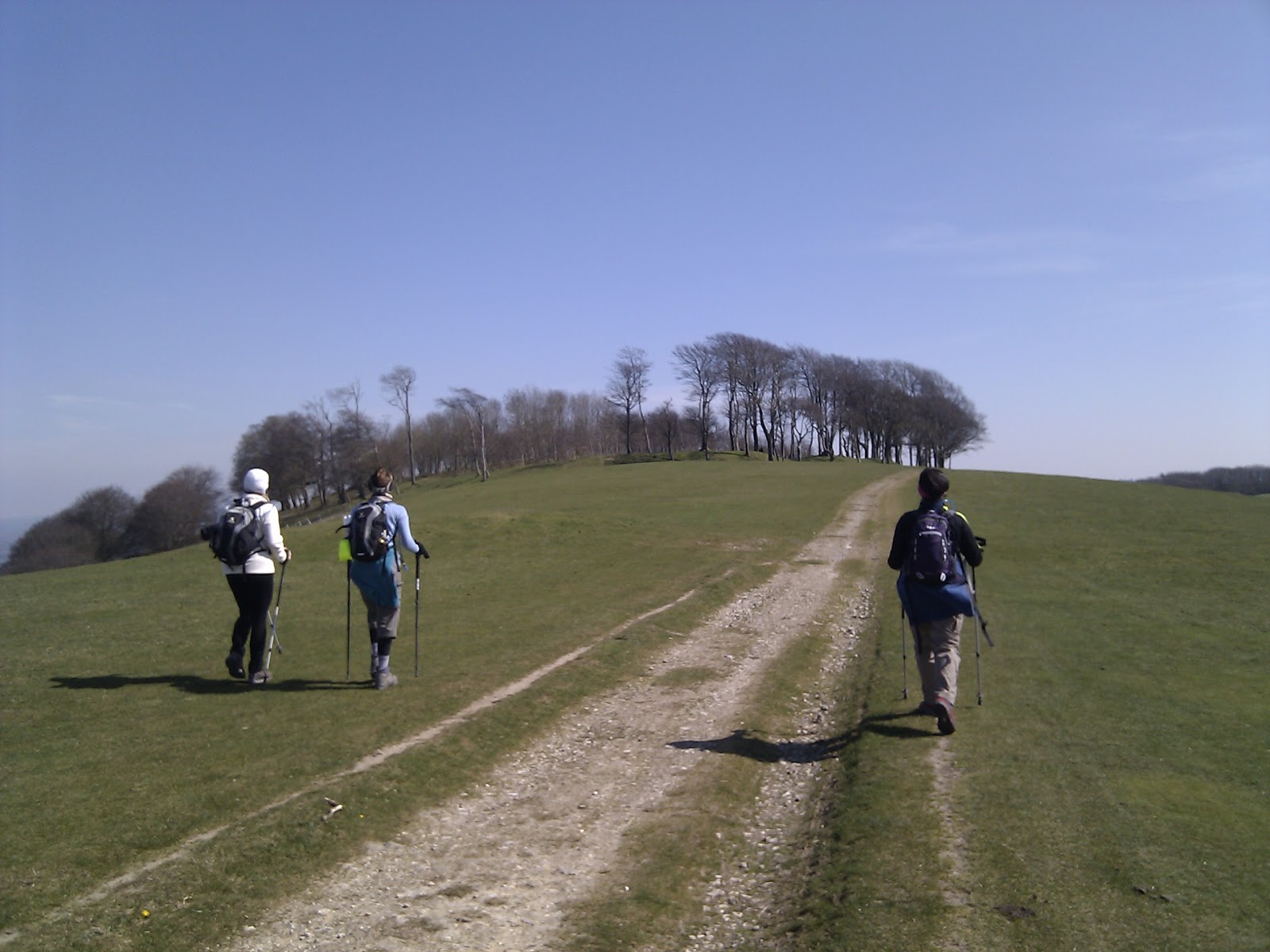
From this point on the topic of conversation turned to being able to see the Jack and Jill windmills that we left hours ago. We knew that we would be able to see them on the hilltop, so at every hill we took on in this stage we were asking ourselves if this was the one we'd be able to see the windmills. It seemed that we'd never get there until finally we got to the top of the last one and we could see them. We knew the end was in sight! At this point Gubbs found that his other walking pole tip had also gone missing. We're going to need spares.

No balls please.
After that it was just a case of wondering through a golf course looking out for flying balls. Luckily for us there weren't any golfers playing with a drive like Gubbs, so we survived to run the gauntlet again in July (though in July will probably be going through here in the early hours of the morning!)

Finally the path took us to Jack & Jill and the car. The sky had at this point clouded over and it felt colder again so we were pleased to be heading home.

We completed our trek in 8 hours and 8 minutes covering 19.5 miles.

Trailwalker Prep Session Hints & Tips

Just getting around to sorting out the notes from the Trailwalker preparation session run by Oxfam and the Queen's Gurkha Signals from a couple of Saturdays ago.

We had an introduction by Tom from Oxfam, then Warrant Officer Stu Coope from the Queen's Gurkha Signals give us some of the key pointers for operations on the day. Finally we had two members of the Haslemere Normans who competed last year running through their tips after their successful Trailwalker completion.

These are the pointers that we took from the session:

Timing
  • Make sure you allocate a time keeper in the team.
  • Think about the checkpoints and allocate a total time to spend at each one, and how long you want to spend at check points in total.
  • Use the table at the front of the maps sent out to you to plan out how long each stage takes and how long to spend at the check point.
  • It is very easy to lose time at checkpoints.
  • Have two plans - one for your ideal scenario, and one for if things don't go to plan and you are slower, or have to stop longer for various reasons, so that you can still stay on track.

Training
  • Between 30-35 miles should be your longest training walk.
  • Use your training walks to find out where you hurt, which muscles could be sore, where you get blisters, etc.
  • Use training walks to try out different foods, drinks and check on who doesn't drink enough.
  • It's recommended that you build up on eating carbs in the 2 weeks before the event.
  • Each person in the team should have experience of reading maps. Have a look on YouTube for videos on how to do this if in doubt.


Support crew
  • The recommended support crew set up is two day members and 2 night support crew members.
  • Make sure each team member has a kit box which can be easily accessed.
  • It is recommended to have a member of the support crew waiting for you when you reach the checkpoint to lead you back to the car and your kit.
  • The support crew should set out four chairs ready for the team to sit down, with a kit box next to each, and lay out blankets for the team to stretch on.
  • Team members should use their time at the checkpoints to sort out blisters, swap socks/clothes and stretch. Eating can be done on route.
  • Support crew should allocate food to each person and have sun cream and drinks ready.
  • It's a good idea for the support crew to arrange surprises for you. They could have music playing at a check point when you arrive, or could dress up in fancy dress, do things to make you laugh, or have special food treats to keep up morale.
  • If you have a runner in your support crew, they could come out and meet the team when they are close to the check point, and then take messages back of what is needed, such as the food being craved for, so it's all ready when the team gets to the check point.
  • Remember that the support team members can fundraise too. Give them sponsor sheets, get them to publicise what you are doing with their friends and family.
  • The 50-60k is a good point for support crew teams to swap over.
  • When swapping, they will need to arrange somewhere to meet away from the checkpoint to swap over the support crew car pass, as each team will only have one.

Kit
  • Bring a waterproof bag to put your phone in for in your pocket/rucksack.
  • Build up a good first aid kit.
  • Make sure you have whistle, torch, head torch and spare batteries.
  • Make sure you have a warm hat for the night time stage. A warm hat is also good to put on during stops at check points.
  • Take lots of spare sets of socks and have talc to put on when you are changing socks.
  • Make sure you take lip balm.
  • Dioralyte rehydrating drinks are a good idea to have available at each check point. Test these out on training walks.
  • Mars bars and snickers bars are good energy snacks.
  • Try out army rations for food. They have good nutrition. Try them out on your training walks.
  • Make sure you have savoury and sweet snacks. Oatcakes, fruit, sandwiches, crisps, as well as sweet things.
  • Check out YouTube clips for binding your feet with Zinc Oxide tape.


Sponsorship and fundraising
  • Give people reasons to sponsor you. Tell them how hard it is and how much effort you are putting in to your training:
    • The average percentage for teams completing as a 4 is 55%.
    • The average finish rate is 75%.
  • Use links to Trailwalker videos to show them how tough it is going to be.
  • The Trailwalker website will soon have some more fundraising ideas.
  • Use social media and blogs to get the message across to your sponsors.


On the Day
  • Registration of team on Friday 13th July between 4pm and 10pm.
  • On registration you pick up your tags and support crew car pass.
  • There is a briefing and cultural show between 7:30 and 8:30 pm.
  • Camping space is available and there is a hot breakfast available in the morning.
  • You will be given a tracking tag on registration. You need to make sure you swipe in and out at each check point. This will keep a record of your timings and can be used by friends and family online to track your progress.
  • Arrive at the event at least 1 hour before your start time if you are not camping the night before.
  • Make sure you make notes of emergency numbers to that these are available to you if you need them. 
  • At checkpoint 7 you will be provided with a hot meal.
  • All checkpoints have hot and cold drinks and water available.
  • Checkpoints 5 and 8 have massages available - but only use these if you really really need them.
  • There are toilets at most checkpoints.
  • Most people tend to find check point 6 to check point 8 the hardest.
  • Check for land marks that you can see. They are useful reference points to check for on the map. For example checkpoint 8 is next to windmills.
  • Showers will be available at the finish.


Some additional tips from the Haslemere Normans
  • Try some early start walks.
  • Fit in short walks during the week to get your mileage up.
  • Get some liner socks.
  • Check point 8 was the hardest point.
  • Make sure you have ibuprofen!
  • Use layers of zinc oxide tape.
  • At checkpoint 9 they were craving salt. Make sure you have something like salty crisps available.
  • The clay gully decent in to checkpoint 9 was really hard work and slippery in the rain.
  • Their full 63 point guide to what they learnt is on their blog.

So there we have it, a long list of helpful tips and hits to help ensure we'll be able to finish this challenge in one piece!


UPDATE: Julie spoke to her brother Royal Marine Major Keith Stanton who had the following additional tips:
  • Tape up feet the night before a walk to make sure there are no parts coming unstuck etc. if there are stick some more tape on top, don't take it all off. Also it saves time in the morning.
  • Try to elevate feet at any rest stops, even if just on top of rucksack, to stop legs and feet swelling and help take pressure off.

Sunday 1 April 2012

Once You Enter, You Can Never Leave This Park

Determination IS everything...
Yesterday we had our Trailwalker prep session with the good people from Oxfam, the Queen's Gurkha Signals and last year's entrants the Haslemere Normans, providing us with the information we need for our challenge in July.

We'll post some of the key points we took from that session once we have reviewed our notes, but for the time being we can say that we found it very useful and gave us an inspirational boost too!

We decided that while we were in Queen Elizabeth Country Park (QECP) it made an awful lot of sense to use this as an opportunity to train on the first two sections of the Trailwalker course.

So Gubbs & Gem dropped a car at the now much used car park in Cocking (checkpoint 2), and met Jo & Julie at QECP prior to the prep session.  After the session, and spurred on with a new sense of determination, we first trekked around the short woodland trail in the park.  This is a 1.9 mile trail around the southern part of the park and the purpose of this was to up the distance on the previous training sessions...as it turned out it probably wasn't required...

A fence-less gate to the countryside
After the short woodland trail we made our way to the Trailwalker start which is on the Northbound side of the A3. You start by walking under the A3 into the car park and along the roads in the park, which we presume on Trailwalker day it will be closed to the park traffic.  We probably should have followed the paths rather than dodge traffic, but we lived to tell the tale so no harm done.

There was a little bit of discussion on the route we were to take as on the supplied 2011 Trailwalker maps it shows the route marked on a path that is not the South Downs Way, which makes its way through the park.

The instructions on the other hand showed that we were going on the South Downs Way, so general confusion ensued (at least between Gubbs and our now official navigator Gem). Gubbs went to check the map board and discovered that the marked out route on the Trailwalker Map was actually a down hill route for mountain bikes... we took our chances with the cars, but down hill mountain bikes were summin' else - following the written instructions it was to be then!

Once we were on a proper track on the South Downs Way we started the ascent up a chalky track. This is not a large ascent but it did seem seem to stretch on.

Wrong way?
We made a couple of turnings and we ended up at the top of a disused quarry, if we had checked our map a little sooner we would have found that we had gone to another part of the park, but we didn't, and we kept going, now going down hill further and further. The last instruction was that we were to get to a small car park in 700m. We had been walking for at least double that so we decided to take some advice we were given earlier by Warrant Officer Stu Coope from the Queen's Gurkha Signals; 'If you think you are lost, Stop, check your map and think about it'.

Walking off piste...
So we stopped... We checked the map... And thought about how stupid the instructions were to have led us here!

We decided that it was best to walk back to the proper trail to ensure we knew where we went wrong for next time. Considering we had walked down a fair distance we weren't looking forward to having a) lost time on the route, and b) to go back up the hill we needlessly walked down.

So it was up to Julie to come up with the ingenious plan of walking/crawling up a very steep bank and cut off a large chunk of path much to everyone else's surprise. Once the initial bank was cleared it was just a case of walking up to the path on the other side of the woodland.

Back we went down to the fork in the path where the error was made and we did eventually make it to the car park on the Eastern edge of the park after 2 hours of walking (including the first woodland loop). Finally we had made it out, and to much celebration too!

Checkpoint one and a view of South Harting
Now things would become easier, in a navigational sense anyway, as it was just a case of following the South Downs Way.

The first stage between QECP and Harting Down has many undulations, none of which strike dread into you when you see them but they all provide a nice warm up for the couple of beasties that you'll be hitting near checkpoint one and also in the first few miles of stage two.

We got to checkpoint one on the top of Harting Down at 5.15pm and we were careful to time our stop, as discussed in the prep session earlier, at 10 minutes. We had a quick stretch and intake of our late lunch and then continued.

Julie & Jo's introduction to Beacon Hill
Gem & Gubbs walked Stage Two between Harting Down and Cocking at the beginning of the month with support team members Peter and Tracy, but for Jo & Julie this was their first time and it was a fine time to introduce them to the now infamous Beacon Hill!

From the bottom it is hard to get the right perspective on how big it actually is, apart from seeing the small gate on the top of the climb.  Once you get going however you realise that it has a nasty steep bit towards to top.

We set off on the climb, which this time Gem & Gubbs were able to complete without having to stop for breathers!  An increase in fitness there perhaps?

Getting to top in one piece the team stopped to enjoy the view and regain some energy.
...and we conquered it!


We followed the trail this time from memory rather than maps and worked our way down the steep decline the other side of Beacon Hill.

This is when Julie demonstrated her preferred method of zigzagging down steep hills in a skiing style. No snow today but this would be a black run!

As the light started to diminish we welcomed in Pheasant Hour (as named last week). We saw plenty of the awkwardly flying things.

As mentioned in our last blog entry for this stage, stage two has some Bronze Age Burial Mounds called the Devil's Jumps just off the path.

Here we stopped to try some of Julie's Banana, Walnut and Honey Bread.  Delicious! It definitely gave the team the extra boost required to complete the walk down into Cocking.

With the walk complete at approx 7:50pm, we were finishing in the dark again for the second week in a row. Next week we have a walk scheduled for Good Friday and this time we will be starting a little earlier!

Total mileage was 16.5 miles with a total time of 5 hours and 56 minutes.  That includes all our stops for food and shouting at the map/instructions.